UTM is one of the most popular projected coordinate systems as it is global and provides high accuracy within the specified zone.
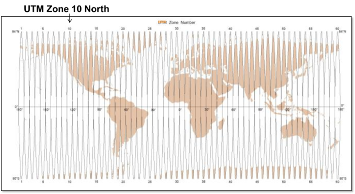
UTM divides up the entire world into 60 "zones" from north to south. Each section is 6 degrees wide. Then, each zone is divided into a northern and a southern part. This gives us the terminology: Zone 10 North for our zone here in Humboldt County (see below).
Note that there are also regions that are labeled with letters. Some folks use the notation "10N" when they mean "10 North". Don't get the regions letters and north and south confused as region "N" is actual in the southern hemisphere and region "S" is in the northern. Always write out the name of the hemisphere you are in (e.g. UTM Zone 10 North).
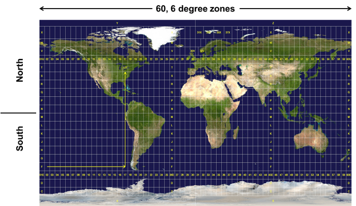
Dividing up the world into these zones results in small areas where the distortion from the projection can be controlled.
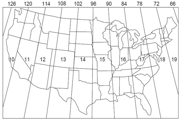
Within the continental US (CONUS), we use zones 10 through 19.
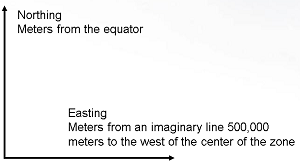
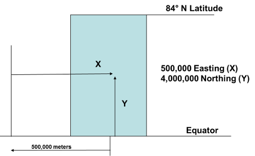
Coordinates in UTM are always specified with a "Northing" and an "Easting". In the northern hemisphere, "Northing" (Y value) is simply measured as the number of meters from the equator. The Easting is measured from an imaginary line 500,000 meters to the west of the center of the zone. This ensures that no coordinate values will be negative, reducing problems when negative signs are dropped.
Below is an example of a UTM coordinate.
For Southern UTM Zones:
The Mathematics for Computing UTM Coordinates are:
Projecting Latitude and Longitude to UTM:
y = northing = K1 + K2p2 + K3p4, where
x = easting = K4p + K5p3, where
© Copyright 2018 HSU - All rights reserved.